
Rebuilding the Reefs of Saginaw Bay: A Collaborative Effort to Restore Fish Habitat and Coastal Health
Project Update (Oct 2025)
How a Great Lakes regional partnership is rehabilitating lost reef habitat in Michigan's Saginaw Bay and why it matters for fish and local communities.
Authors: Andrea Miehls, Great Lakes Fishery Commission; Dave Fielder, Michigan Department of Natural Resources; Terry Heatlie, National Oceanic and Atmospheric Administration; Jeff Jolley, Michigan Department of Natural Resources; Jeff Tyson, Great Lakes Fishery Commission; and Jill Wingfield, Great Lakes Fishery Commission.
 Channel Island Saginaw Bay Reef Construction Drone Photo - Z. Allan, GLFC.jpg)
 Channel Island Saginaw Bay Reef Construction Drone Photo - Z. Allan, GLFC.jpg)
 Channel Island Saginaw Bay Reef Construction Drone Photo - Z. Allan, GLFC.jpg)
 Channel Island Saginaw Bay Reef Construction Drone Photo - Z. Allan, GLFC.jpg)
 Channel Island Saginaw Bay Reef Construction Drone Photo - Z. Allan, GLFC.jpg)
 Channel Island Saginaw Bay Reef Construction Drone Photo - Z. Allan, GLFC.jpg)
 Channel Island Saginaw Bay Reef Construction Drone Photo - Z. Allan, GLFC.jpg)
 Channel Island Saginaw Bay Reef Construction Drone Photo - Z. Allan, GLFC.jpg)
 Channel Island Saginaw Bay Reef Construction Drone Photo - Z. Allan, GLFC.jpg)
 Channel Island Saginaw Bay Reef Construction Drone Photo - Z. Allan, GLFC.jpg)
Construction of Channel Island Reef in inner Saginaw Bay, Lake Huron. The new reef replaces lost fish habitat and helps more fish reproduce and grow, supporting a variety of fishing opportunities and increasing resilience of the ecosystem to future changes. Credit: Zak Allan, GLFC.
Saginaw Bay, an embayment along the western shore of Lake Huron in Michigan, has long been known for its abundant fish, dynamic shorelines, and biological richness. But decades of stressors, including sediment inputs from land-use practices, pollution, invasive species, and habitat degradation, have erased much of what made the bay thrive, especially the rocky spawning reefs upon which many economically-valuable native fish depend. These stressors and the resultant environmental degradation led the International Joint Commission to designate Saginaw Bay as an Area of Concern in 1987.
Now, a partnership among the Great Lakes Fishery Commission ("Commission") and multiple federal and state agencies, universities, and small businesses is seeking to reverse this degradation through the Inner Saginaw Bay Reef Restoration Project. The project is part of a broader Regional Habitat Partnership between the Commission and the National Oceanic and Atmospheric Administration, which seeks to protect, restore, and improve fish habitat across the Great Lakes basin. Restoration of fish habitat in Saginaw Bay is also a priority of the Michigan Department of Natural Resources (DNR) via the Walleye Recovery Plan, which prescribed diversifying spawning sources of walleye in the bay to build resilience in the population.
In September-October 2025, restoration efforts in inner Saginaw Bay moved from planning to action—or more accurately, from blueprint to barge. Just east of Channel Island near the mouth of the Saginaw River, crews deployed tons of limestone cobble onto the bay floor, constructing a new reef which reintroduces the rocky habitat that native fish like lake whitefish and walleye once relied on to spawn—habitat that had all but vanished owing to sedimentation in the bay.
Drone footage captures the construction of Channel Island Reef in inner Saginaw Bay, Lake Huron. Credit: Zak Allan, GLFC.
The Problem: Lost Reefs, Lost Fisheries
Saginaw Bay is one of the largest bays in the Great Lakes, covering approximately 1,150 square miles with a watershed spanning 5,500 square miles and 22 counties. The bay’s fisheries today are valued at more than $30 million annually to the region.
Walleye have long been a cornerstone of Saginaw Bay’s fish community. At the peak, the bay supported one of the most productive commercial walleye fisheries in the Great Lakes—second only to Lake Erie—with annual harvests exceeding one million pounds. Walleye, along with other important fishery species such as cisco, lake whitefish, and lake trout, relied on the bay as a seasonal spawning and nursery ground.
Much of this fish productivity was supported by the bay’s once-abundant rocky reefs—glacially deposited cobble and stone that provided ideal conditions for spawning, egg incubation, and juvenile development. These reefs also offered shelter from predators and strong currents. Over time, however, many were buried by sediment or eroded away. For species that depend on rocky areas to reproduce, the resulting soft, silty bottoms were poor replacements.
By the mid-1940s, the Saginaw Bay walleye fishery had collapsed, owing to poor reproduction due to degraded spawning habitat and construction of dams in the watershed. Overfishing and effects of invasive species, particularly alewife, compounded the negative effects of habitat alteration. Other notable fisheries, including cisco, also collapsed during this time.
The changes in habitat and the resulting negative effects on fish have cascading effects that ripple throughout the ecosystem and into local communities and economies. Fewer fish means reduced fisheries harvests and loss of economic value; less habitat complexity means less resilience to changing conditions; and weakened natural shorelines leave coastal communities more exposed to erosion, flooding, and storms.
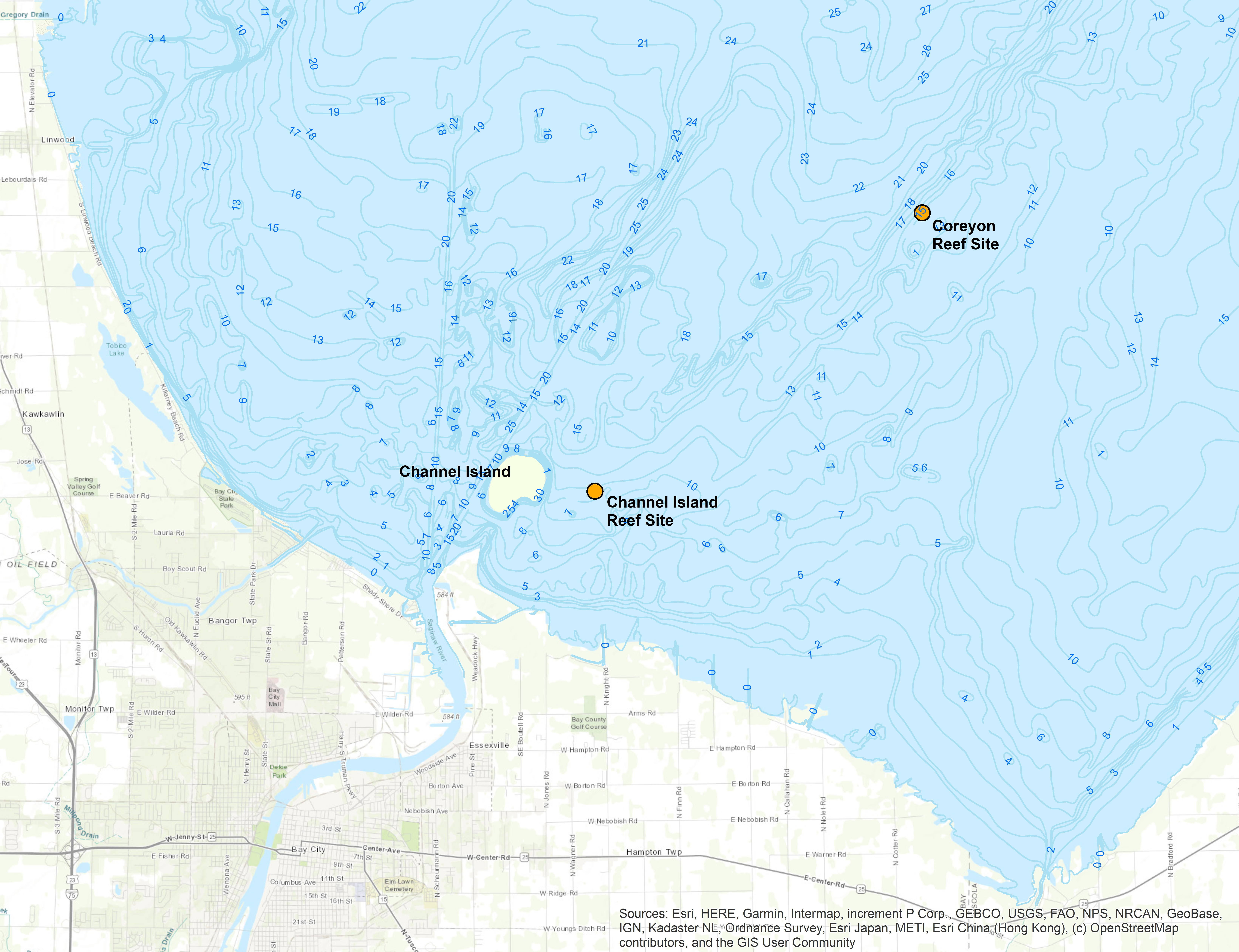
Location of Channel Island Reef and Coreyon Reef in Saginaw Bay, Lake Huron. The two reefs complement each other spatially, providing nearshore (Channel Island Reef) and offshore (Coreyon Reef) fish habitat. Credit: Environmental Consulting & Technology, Inc.
The Project: Inner Saginaw Bay Reef Restoration
The Inner Saginaw Bay Reef Restoration Project aims to reestablish lost spawning reef habitat in the bay, thereby diversifying sources of reproduction and improving fish production, both of which provide benefits to fisheries harvests and resilience to future stressors. Habitat is being restored using natural materials (gravel, cobble, rock) in locations selected which contain suitable thermal conditions, water depth, nursery habitat connectivity, and sediment dynamics.
In 2022, Michigan DNR and Environmental Consulting & Technology carried out a feasibility study for reef restoration in Saginaw Bay. The study included hydrodynamic and sediment transport modeling, bathymetric mapping, and side-scan sonar surveys. Through this study, coupled with a public input process engaging local stakeholders, a site near Channel Island in the inner bay, about two miles northeast of the mouth of the Saginaw River, was selected for restoration. This site was also selected to serve as a nearshore complement to the recently constructed Coreyon Reef, a 2-acre reef created in 2019 approximately eleven miles from shore.
After selection, a reef design process was initiated. Rigorous pre-restoration monitoring of sediment contaminants, the fish community, and fish spawning use, was also conducted. And once the U.S. Coard Guard confirmed that the location and design criteria of the reef did not interfere with navigation, construction was ready to begin.
During September 2025, approximately 20,000 tons of limestone rock—ranging from 4 to 8 inches in diameter, the optimal size for egg incubation and protection—were deposited via barge approximately 0.5 miles east of Channel Island. The resulting structure contains over 300,000 cubic feet of fish spawning habitat in a reef that measures 570 feet long by 190 feet wide (totaling 2.5 acres). The reef rises 3-4 feet above the bay bottom and sits at least 5.5 feet below the water’s surface, even when water levels are low. The reef cost $1.74 million to construct.
To imagine the size of the new reef, picture two football fields placed end-to-end, with a player buried chest-deep in softball-to-volleyball size rock! The total volume is about the size of a large concert hall. To create this massive structure, a whopping 40 barge loads of limestone were needed and crews ran 24/7 during project construction. The stone was installed on the bay bottom using a grapple attachment on a crane, like the toy claw machine in an arcade. Because the grapple attachment was so large (~15 feet tall), the limestone was essentially placed—not dropped—on the bottom. This allowed for precision placement of the material to obtain uniform depths and meet design plans and specifications.
 Saginaw Bay Reef Construction Pictures - Jeff Tyson, GLFC.jpg)
 Saginaw Bay Reef Construction Pictures - Jeff Tyson, GLFC.jpg)
 Saginaw Bay Reef Construction Pictures - Justin Menard, Walsh Service Solutions.jpg)
 Saginaw Bay Reef Construction Pictures - Justin Menard, Walsh Service Solutions.jpg)
 Saginaw Bay Reef Construction Pictures - Justin Menard, Walsh Service Solutions.jpg)
 Saginaw Bay Reef Construction Pictures - Justin Menard, Walsh Service Solutions.jpg)
 Saginaw Bay Reef Construction Pictures - Justin Menard, Walsh Service Solutions.jpg)
 Saginaw Bay Reef Construction Pictures - Justin Menard, Walsh Service Solutions.jpg)
 Saginaw Bay Reef Construction Pictures - Justin Menard, Walsh Service Solutions.jpg)
 Saginaw Bay Reef Construction Pictures - Justin Menard, Walsh Service Solutions.jpg)
Construction of Channel Island Reef in inner Saginaw Bay, Lake Huron. Construction crews worked day and night over a 5-week period. Credit: Jeff Tyson, GLFC (photos 1-2); Walsh Service Solutions, LLC (photos 3-10).
The Next Steps: Measuring Success
Design of the newly-constructed Channel Island Reef relied on lessons learned from Coreyon Reef, notably materials and techniques used during construction. In less than five years post-construction, Coreyon Reef has become a hot spot for fishing and fish reproduction, with documented spawning by lake whitefish and walleye in addition to habitat use by many other fish species.
To evaluate whether Channel Island Reef experiences similar success, post-construction monitoring will assess spawning, survival, and recruitment of fish, sediment movements, and other functional habitat characteristics, in addition to community benefits such as fishing opportunities, recreational use, and coastal protection. Like Coreyon Reef, Channel Island Reef will have a commercial fishing exclusion zone in place. Additional details on post-construction assessments can be found in the Quality Assurance Project Plans for fish communities and sediment.
The Future: A Shared Vision for a Healthier Bay
By restoring critical reef habitat, the Inner Saginaw Bay Reef Restoration Project is expected to rebuild fish populations, strengthen ecosystems, and support human communities that depend on a healthy bay. Reef restoration has the potential to not only enhance fish populations and fisheries, but also boost biodiversity, contribute to coastal resilience by reducing erosion, and support local economies. In the broader context of the Regional Habitat Partnership, this work helps fulfill a shared vision of resilient fish communities, connected habitats, and widespread benefits to the Great Lakes and the people who depend on them.
Partners & Funding
This project is conducted in partnership among the National Oceanic and Atmospheric Administration; Michigan Department of Natural Resources; Michigan Department of Environment, Great Lakes, and Energy; Environmental Consulting & Technology, Inc; LimnoTech; Walsh Service Solutions, LLC; Ryba Marine; Purdue University; Michigan Sea Grant; Michigan State University Extension; and the Great Lakes Fishery Commission.
Funding has been provided by the National Oceanic and Atmospheric Administration; Great Lakes Restoration Initiative; Great Lakes Fish and Wildlife Restoration Act; National Fish and Wildlife Foundation—Coastal Resilience Fund; and Dow Chemical Natural Resources Damage Assessment and Restoration settlement money.
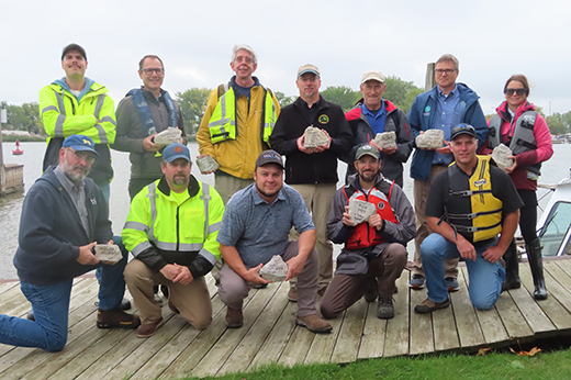
Project partners for the Inner Saginaw Bay Reef Restoration Project hold signed and personalized rocks which are now part of the new Channel Island Reef (Lake Huron), which provides habitat for future generations of fish. Credit: Jill Wingfield, GLFC.
Mission Accomplished, Nebagamon Creek, Lake Superior
Project Update (Sept 2024)
Time lapse footage of the removal of an abandoned railroad grade and culvert on Nebagamon Creek (Douglas County, Wisconsin) during August-October 2023. Credit: Great Lakes Fishery Commission and National Oceanic and Atmospheric Administration.
The text below is based on excerpts from an article originally printed in the 2024 edition of the Lake Superior Angler. The Angler is an annual publication produced by the Lake Superior Steelhead Association (LSSA). This text is being reprinted by permission of the LSSA.
Authors: Paul Piszczek, Wisconsin DNR Fisheries Biologist and Dennis Pratt, Brule River Sportsmen’s Club President, and retired Wisconsin DNR Fisheries Biologist
Mission Accomplished, the South Shore Rail Grade on Nebagamon Creek is gone. In 1934, a defunct railroad company left its grade on Nebagamon Creek, the Bois Brule River’s largest tributary. Eighty-nine years later, in 2023, the grade was removed after governments and non-governmental organizations partnered to achieve the goals of eliminating the grade’s sedimentation threat to Wisconsin’s Bois Brule River and improving fish passage throughout the watershed.

Nebagamon Creek facing west (after completion of construction). Credit: Paul Piszczek, Wisconsin DNR.
The Project was completed on October 13, 2023, after construction began on August 16, 2023. [Construction] consisted of removing nearly 30,000 cubic yards of fill material (generally sand and clay), which was done with excavators, off-road dump trucks, and bulldozers. Construction also consisted of clearing trees, transporting the material to a local gravel pit, removing the extant concrete culvert and wing walls, installing in-channel grade controls such as cobble/boulder riffles, and installing large wood within the new stream channel margins. Many of the trees, cobbles, and boulders cleared and excavated from the site during construction were re-used in the new stream channel as fish habitat and channel geomorphological features where appropriate.

(Left) Railroad grade facing up stream (before construction). (Right) Railroad grade facing up stream (during construction). Credit: Paul Piszczek, Wisconsin DNR.
Wren Works, LLC (Poplar, WI) was the construction contractor and Beaver River Consulting (Duluth, MN) was the design engineer, which also provided construction oversight during new stream channel and floodplain construction. The Town of Brule and Olson Bros. Contractors provided final grading on Bellwood Pit Road. [Wisconsin] DNR Fisheries frequently visited the site and provided guidance throughout the construction period. The project’s total cost was approximately $850,000.
The project’s final product is Nebagamon Creek’s daylighted and free-flowing condition. Its channel and valley dimensions closely match those of the upstream and downstream segments, and whose channel and valley are no longer susceptible to any risk associated with the rail grade’s potential collapse.
[The] combined public and private efforts over the last eight years removed the grade’s soils and culvert before they had a chance to impact Nebagamon Creek more heavily and the Bois Brule River. Many thanks to all the government agencies, individuals, businesses, and organizations who donated funds to proactively manage habitat in the Bois Brule River Watershed.

Railroad grade facing up stream (after completion of construction). Credit: Paul Piszczek, Wisconsin DNR.
Read the full article online: Mission Accomplished, Nebagamon Creek.
This work was completed in partnership by the Great Lakes Fishery Commission, National Oceanic and Atmospheric Administration, Wisconsin Department of Natural Resources, Wisconsin Department of Agriculture, Trade and Consumer Protection, Douglas County, Town of Brule, Brule River Sportsmen’s Club, Brule River Preservation, Inc., and Izaak Walton League.
Funding was provided by the NOAA Regional Habitat Partnership, Wisconsin Department of Natural Resources, US Fish and Wildlife Service Fish Passage Program, Brule River Rats Stewardship Council, Brule River Sportsmen's Club, Brule River Preservation, Inc., and Izaak Walton League.
Great Lakes Habitat Restoration: Partnering to Promote Fish Production
Project Overview (Oct 2023)
A new Regional Habitat Partnership between the Great Lakes Fishery Commission and National Oceanic and Atmospheric Administration will support fish habitat restoration priorities in the Great Lakes.
Authors: Andrea Miehls, GLFC, Jeff Tyson, GLFC, Jill Wingfield, GLFC, and Julie Simmons, NOAA
Degradation of coastal, nearshore, and riverine habitats has adversely affected fish communities and fisheries in the Great Lakes for more than a century. Now a partnership between the National Oceanic and Atmospheric Administration (NOAA) and the Great Lakes Fishery Commission (Commission) is advancing restoration goals for important habitat for Great Lakes fish. Working with NOAA Fisheries through a Regional Habitat Partnership funded at $4.8 million by NOAA, the Commission, along with local partners, is leading implementation of high priority projects as identified by Lake Committees across the Great Lakes basin.
The Lake Committees, which include representation by senior officials from state, provincial, and U.S. intertribal fishery agencies, conducted an extensive process to identify habitat constraints on native fish production and to prioritize restoration efforts during the next decade in each of the Great Lakes. High-quality connected habitats are important for sustained fish production—by protecting and improving habitat, fish communities and their associated fisheries can directly benefit. Fish habitat improvement techniques range from regional-scale actions that impact water quality and sediment erosion, to local actions that improve connectivity (e.g., dam removal) or restore open-lake physical habitat (e.g., reef construction). Selecting appropriate strategies and locations for habitat protection and improvement is critical. Consequently, the development of priorities is an important step for progress toward protecting and improving fish habitat.
Prioritization Process
The prioritization process conducted by the Lake Committees yielded a set of priority projects in each Great Lake. A subset of six of the priority projects—ranging from shovel-ready to conceptual—was included as part of the regional partnership. All six projects will directly contribute to fish production in areas identified by the Lake Committees as priorities. The six projects span the breadth of the Great Lakes with at least one project in each Great Lake, and will benefit a variety of fish species such as state-listed species (lake sturgeon) and targeted species in formal restoration plans (walleye, brook trout, Atlantic salmon, cisco, lake trout). Impairments addressed in these projects include degraded reef substrates, hydrologic barriers in tributaries, excessive in-stream bank erosion, and lack of productive capacity. The projects include four projects being addressed in the first wave of activity (detailed below) and two additional projects which will move forward in a second wave.
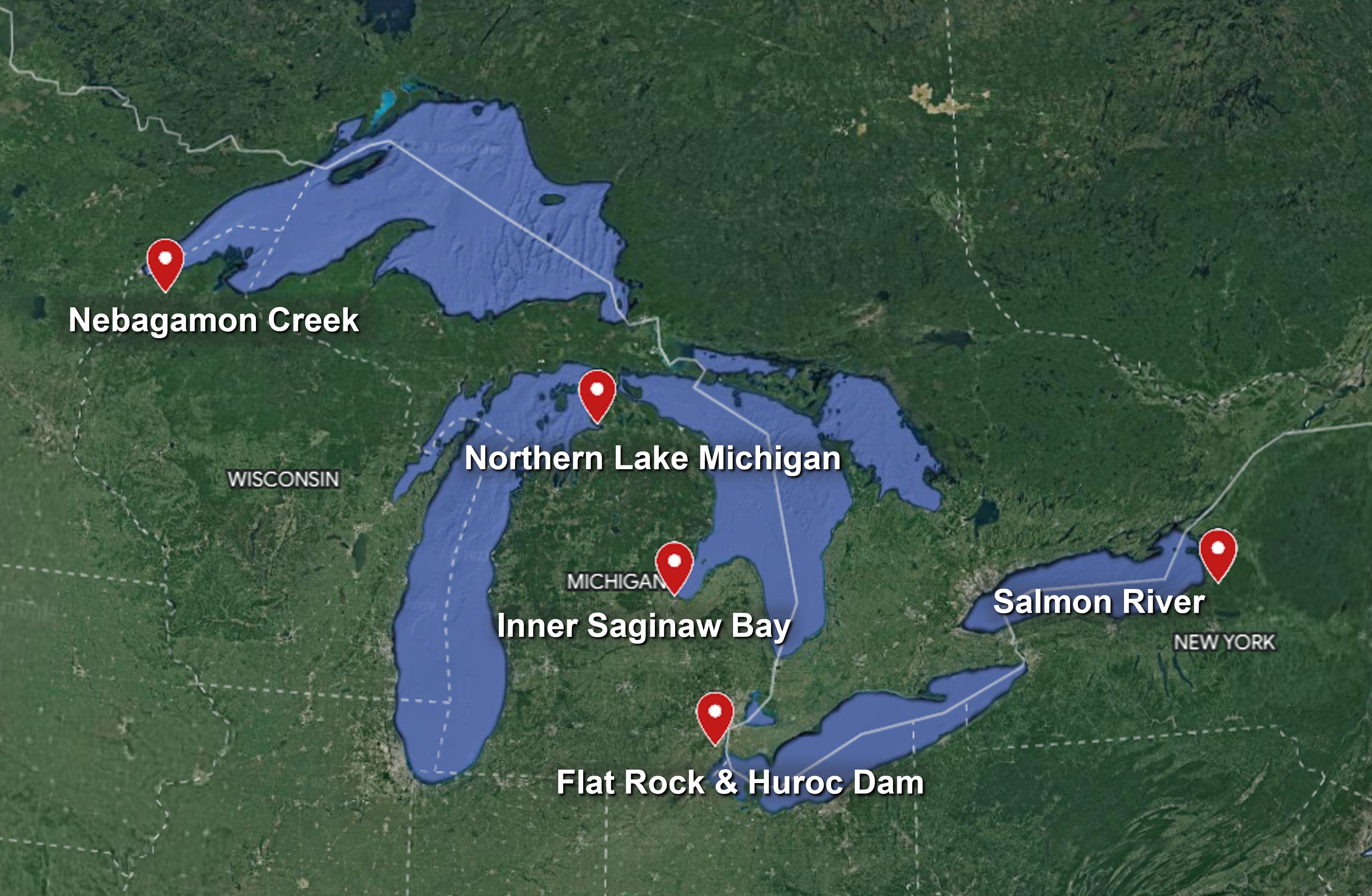
Map of the six project sites selected during the prioritization process, with at least one site on each Great Lake. Note that the Salmon River site includes two projects. Credit: Andrea Miehls, GLFC.
Project Spotlight
Lake Superior: Nebagamon Creek Railroad Embankment and Culvert Removal Project
Location: Nebagamon Creek, Douglas County, Wisconsin.
Partners: GLFC, NOAA, Wisconsin Department of Natural Resources, Wisconsin Department of Agriculture, Trade and Consumer Protection, Douglas County, and the Town of Brule.
Timeline: Construction began in summer 2023 and will complete by fall 2023, followed by post-restoration monitoring in 2023-2025.
Overview: Nebagamon Creek is a tributary to the Bois Brule River. The Nebagamon Creek restoration site is a collapsing culvert and abandoned railroad grade that impedes fish passage for all life stages of brook trout and other Lake Superior and resident salmonids in the Bois Brule River watershed. In its current condition, the site also poses a high-risk sediment threat to downstream spawning and rearing areas in Nebagamon Creek and the Bois Brule River. The project will remove the collapsed culvert and railroad embankment and will restore natural hydrologic conditions for fish passage and sediment transport in the project area.
More information: www.glfc.org/rhp-nebagamon-creek.php.
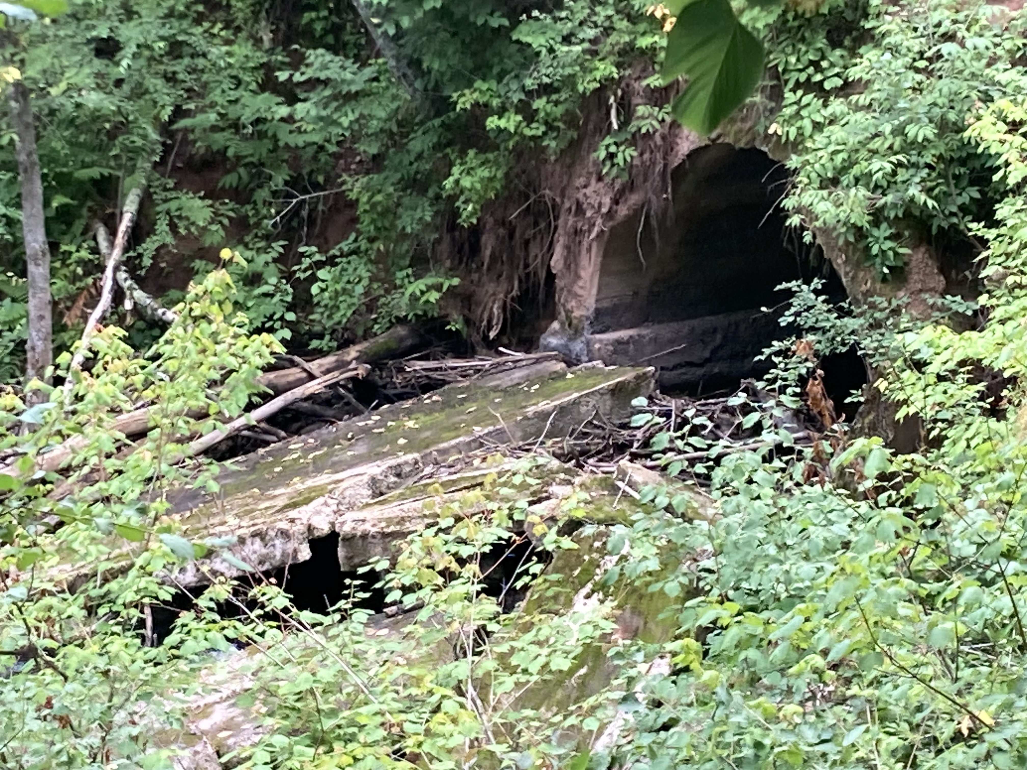
The Nebagamon Creek Railroad Embankment and Culvert Removal Project site. The collapsed culvert, which impedes nearly all fish passage, is visible in the center-right of the photo. Credit: Jeff Tyson, GLFC.
Project Spotlight
Lake Ontario: Salmon River Trestle Pool Project
Location: Salmon River, Oswego County, New York.
Partners: GLFC, NOAA, New York State Department of Environmental Conservation, US Fish & Wildlife Service-New York Field Office, and the Finger Lakes Lake Ontario Watershed Protection Association.
Timeline: Construction began in summer 2023 and is anticipated to be completed by fall 2024, followed by post-restoration monitoring in 2024 and 2025.
Overview: The Salmon River is a key tributary to Lake Ontario for Atlantic salmon restoration. The trestle pool restoration site, which consists of an abandoned railroad trestle with associated abutments, backs up water during high flow events, inhibits sediment transport, increases upstream sedimentation, and induces streambank erosion in the downstream reaches. The area contains degraded riparian and stream conditions which contribute to unsuitable habitats for Atlantic salmon spawning and rearing. This project will remove the abandoned railroad central pier and left abutment to provide hydrologic reconnection to the floodplain and restore habitat heterogeneity, while reducing in-stream and bank erosion through installation of in-stream structures and toe-wood bank stabilization structures. This work is being guided under the Lower Salmon River Restoration and Recreation Enhancement Plan.
More information: www.glfc.org/rhp-salmon-river.php.
The Salmon River Trestle Pool Project site. The abandoned railroad central pier and left abutment slated for removal are visible in the center-left of the photo. Credit: Jeff Tyson, GLFC.
Project Spotlight
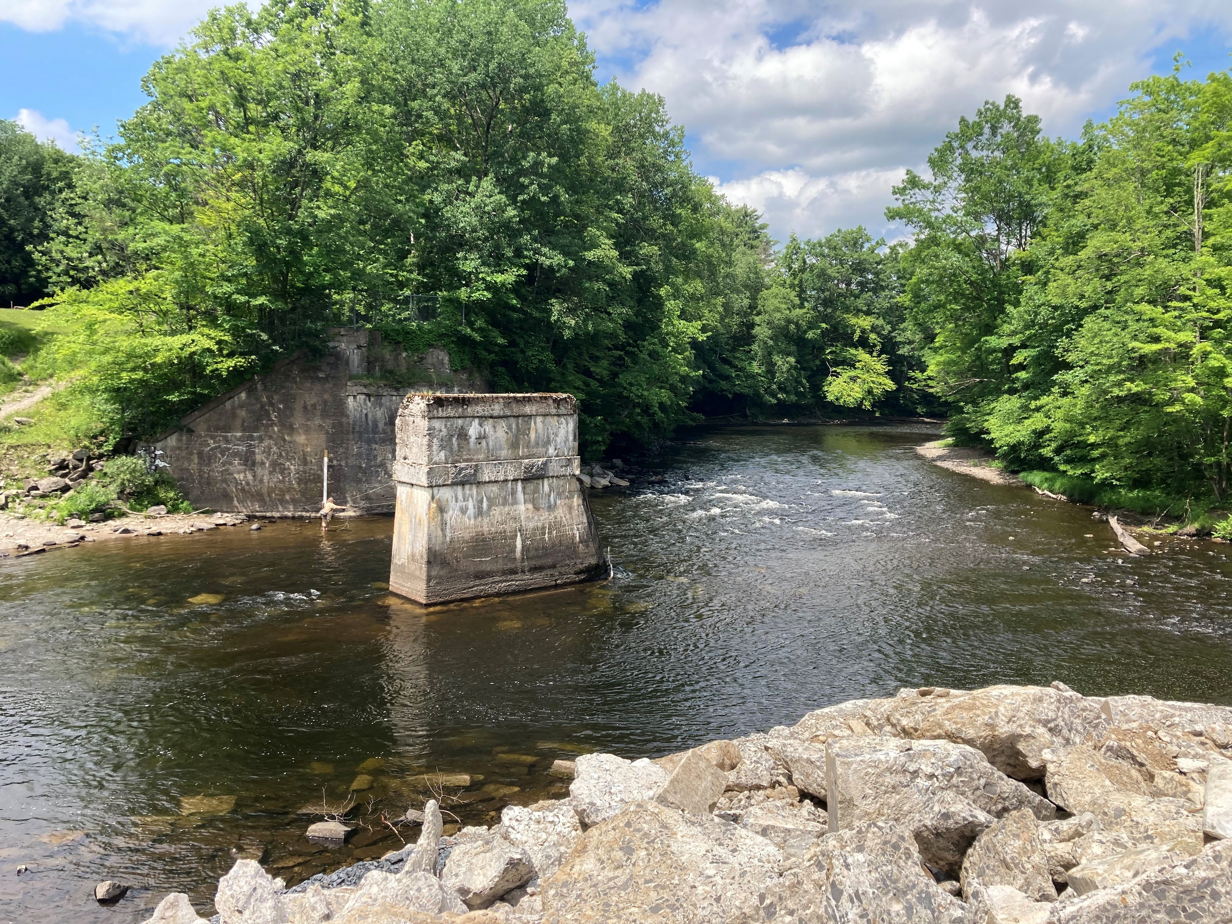
Lake Erie: Flat Rock/Huroc Dam Fish Passage Project
Location: Huron River, Wayne County, Michigan.
Partners: GLFC, NOAA, Huron-Clinton Metroparks, Michigan Department of Natural Resources, Huron River Watershed Council, and the City of Flat Rock.
Timeline: The feasibility study is being conducted from spring 2023 to spring 2024.
Overview: The Flat Rock and Huroc dams are located on the Huron River, Michigan and are the first significant fish passage barriers upstream from Lake Erie. The two barriers restrict fish passage and limit production for multiple species of common concern including lake sturgeon, walleye, and white bass, and have downstream impacts to hydraulic connectivity and habitat. Additionally, multiple species of concern, including native mussels such as snuffbox, elktoe, purple wartyback, and the wavy-rayed lampmussel, as well as their host-fish species, logperch, smallmouth bass, eastern sand darter, and spotted sucker, are documented in this river system. This project is focused on developing a feasibility study that considers alternatives for the Flat Rock and Huroc dams that will benefit the community and surrounding natural habitats and enhance fish passage at the site. Goals include improved fish passage and reconnecting important tributary habitat to Great Lakes species while also minimizing the risk of invasive sea lamprey infestation.
More information: www.glfc.org/rhp-flat-rock.php.
The Flat Rock (left) and Huroc (right) dams in the Huron River, Michigan. Credit: Jeff Tyson, GLFC.
Project Spotlight
Lake Huron: Inner Saginaw Bay Reef Restoration Project
Location: Saginaw Bay, Bay County, Michigan, with restoration sites in the vicinity of the Kawkawlin River outlet and/or near Spoils Island.
Partners: GLFC, NOAA, Michigan Department of Natural Resources, Michigan Department of Environment, Great Lakes, and Energy, and Michigan Sea Grant.
Timeline: Stakeholder workshop scoping, feasibility work, and completion of design plans is expected in late 2023 or 2024, with construction planned in 2024-2025 after identification of the preferred restoration site and completion of final design plans.
Overview: Reef habitats in Saginaw Bay have been degraded by impacts from physical destruction, degradation from shoreline development, sedimentation, chemical contamination, and aquatic invasive species. This project will establish needed spawning habitat in inner Saginaw Bay for multiple species of common concern, including lake trout, lake whitefish, walleye, and cisco. Natural materials and established techniques will be used in the construction of the reef, and the reef will be located in proximity to appropriate thermal conditions for spawning and rearing of these species. In addition to enhancing production for important fish species that support fisheries, this project has the potential to be conducted in concert with other shoreline infrastructure work to reduce coastal flooding and erosion, reduce the frequency of navigational dredging, increase recreational access, and increase coastal resilience to climate change.
More information: www.glfc.org/rhp-saginaw-bay.php.
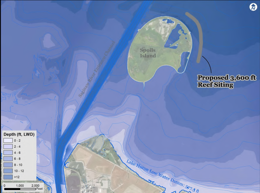
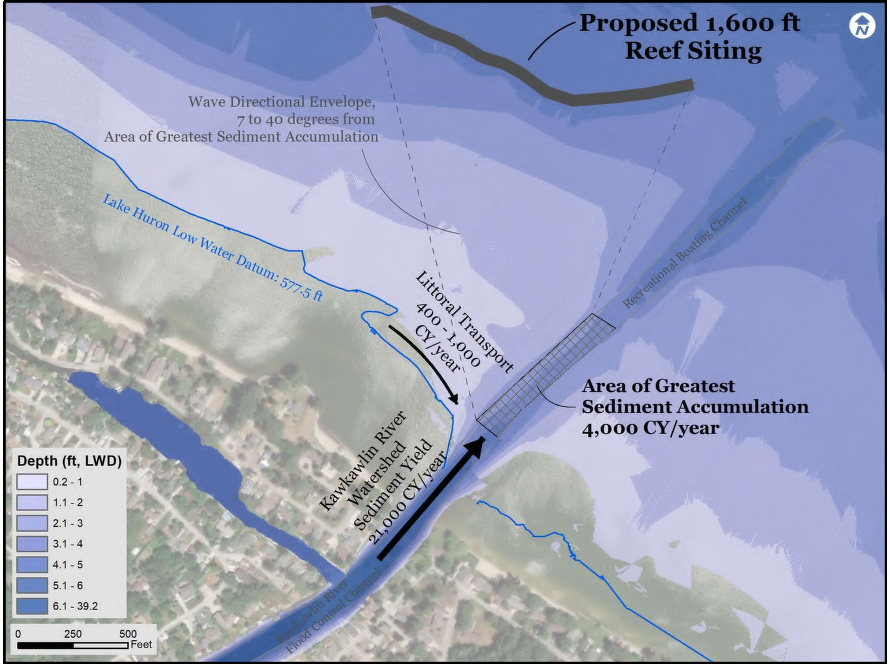
Inner Saginaw Bay Reef Restoration Project potential locations at Spoils Island (left) and the Kawkawlin River outlet (right). Source: Saginaw Bay Reef Feasibility Study, February 2022, ECT No.200654.
Additional Priority Projects Soon to be Addressed
In addition to the four ongoing projects highlighted above, two additional projects are planned for the future. The first is reef restoration in northern Lake Michigan (near Charlevoix, Michigan – exact location to be determined). This project will identify restoration locations and guide restoration actions for reef rehabilitation in northern Lake Michigan, improving habitat for lake whitefish, lake trout, and cisco. The second is additional in-stream habitat restoration in the Salmon River, Lake Ontario (Oswego County, New York). This project will focus on restoration of natural erosion and sedimentation processes, and reconnection to the floodplain, in two reaches directly downstream of the Trestle Pool site to improve habitats for Atlantic salmon and other native species.
Strengthening Great Lakes Fisheries, Ecosystems, and Communities
The Great Lakes and St. Lawrence River basin include more than 10,000 miles of coastline that are home to more than 3,500 plant and animal species, some of which are found nowhere else on Earth. Yet, extensive human activity for more than a century has led to the loss of habitat for fish, negatively impacting fish production and fisheries in addition to other negative impacts on the region's rich and diverse ecosystems.
The new Regional Habitat Partnership between NOAA and the Commission is working to address critical habitat needs in priority areas of the Great Lakes, thereby contributing to healthy Great Lakes ecosystems and fisheries.
"NOAA is proud to partner with the Great Lakes Fishery Commission on these important efforts to restore habitat and bring benefits to Great Lakes fisheries and communities," said Carrie Selberg Robinson, director of the NOAA Fisheries Office of Habitat Conservation.
"Habitat restoration efforts enacted through the partnership will further the Strategic Vision of the Commission and missions of project partners by restoring healthy Great Lakes ecosystems and sustainable fisheries and through the development of strategic alliances and partnerships," said James McKane, the Commission's chair.
McKane added, "Working together through the Regional Habitat Partnership, the Commission, NOAA, and other project partners endeavor to sustain the many benefits the Great Lakes provide to our environment and communities."
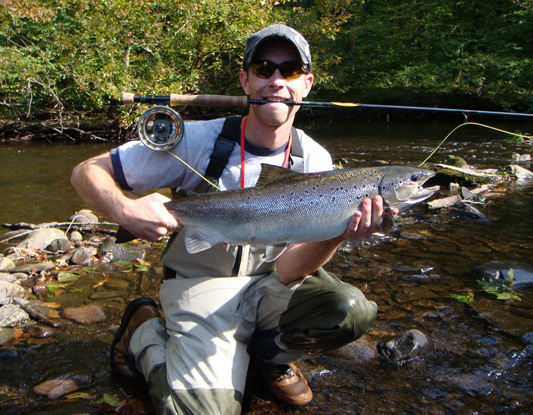
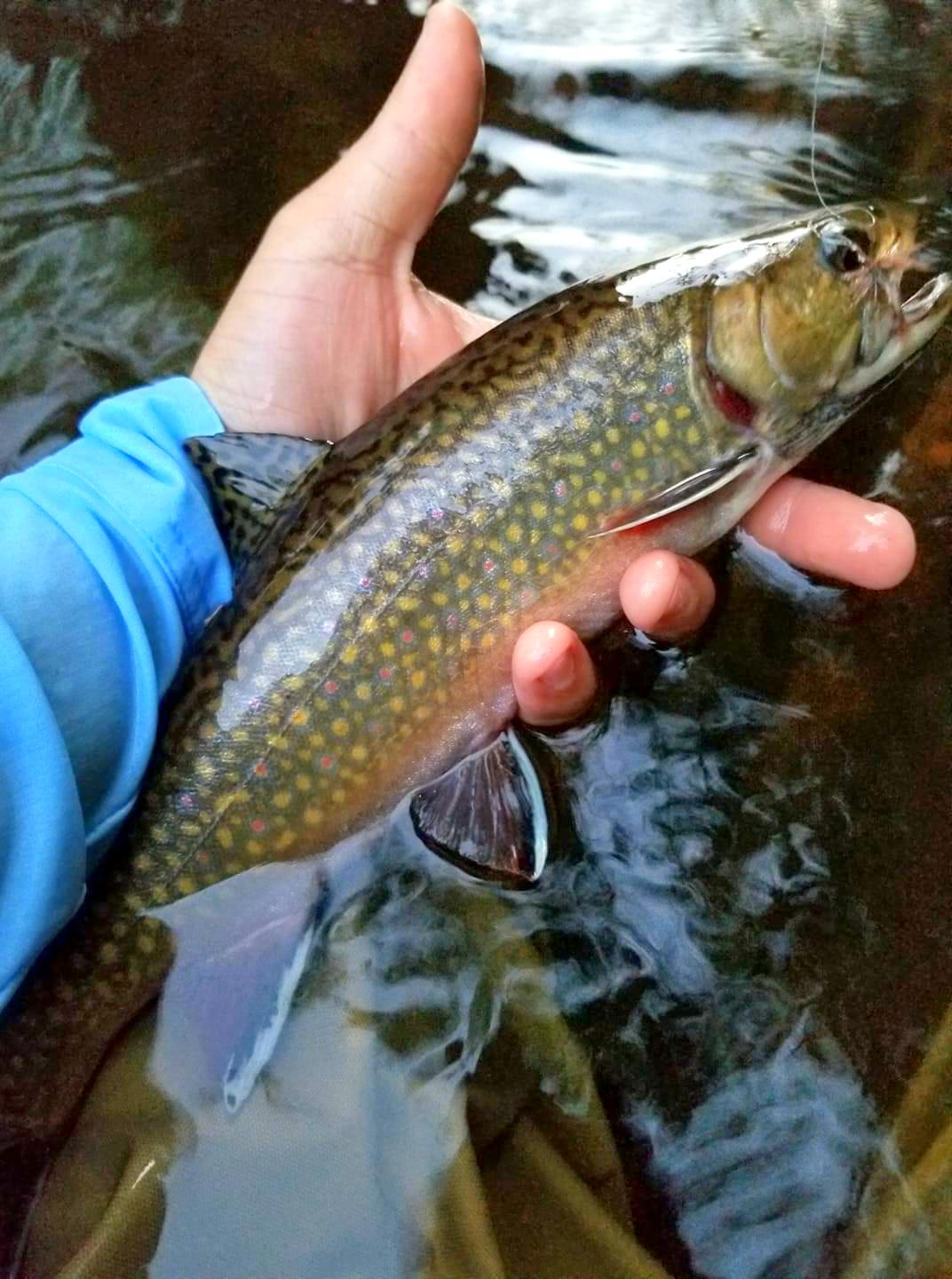
Anglers hold an Atlantic salmon (left) and brook trout (right), two species which will benefit from habitat restoration activities through the Regional Habitat Partnership between NOAA and the Commission. Credits: USGS (left) and Zac Wickert (right).
Read more Pulse on Science: Project Spotlights
- New Study Concludes Invasive Sea Lampreys Can Be Controlled by the Release of Sterilized Males
- Happy 75th anniversary to Hammond Bay Biological Station!
- Great Lakes Habitat Restoration: Partnering to Promote Fish Production
- Sea Lamprey Control Spreads the Distance
- Making the Best of a Bad Situation: Great Lakes Sea Lampreys Reveal the Origins of Vertebrate Traits
- Studying the Fish of Buffalo Reef, Traverse Bay, Lake Superior
- Doing Science is Essential...Communicating Science is Just as Critical (and maybe more FUN!)
- Faithful Fish: Walleye Show High Spawning Site Fidelity in the Great Lakes
- Finding the Sea Lamprey's Kryptonite
- Good Things Come in...Polymer Packages?
- Rambunctious Reproduction Overheard Among Great Lakes' Lake Trout
- Clearer Water Means Less Fish: Understanding How Lower Trophic Level Changes Impact Lake Huron's Fisheries