<<< Back to Lake Erie Habitat-Project Inventory HOME Page
Basin- and Lake-Wide Habitat-Related Project Inventory
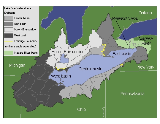
Click on a region of the map or a link below to view a spatial inventory of projects in that region.
Basin-Wide - Lake-Wide - Multiple Basins
|
|
Project Title |
Project Type |
Watershed(s) |
Waterbody(ies) |
Location |
Status |
Lead Agency/ Partners |
Variables measured |
Documents |
Contact |
Links |
|
1 |
|
Rehabilitation Strategies (workshops, working groups, tools development) |
|
|
|
Ongoing |
GL Millennium Network / multiple, bi-national partner list |
|
|
J.
Ciborowski, 36 Biology Building, |
|
|
Description:
An ongoing series of workshops designed to focus management needs and
coordinate research toward a better understanding the |
|||||||||||
|
2 |
A
Geographic Information System for |
Rehabilitation Strategies (workshops, working groups, tools development) |
|
|
Lakewide and Basinwide |
Complete |
USFWS, USEPA, MDNR, GLFC |
|
|
C. Geddes |
http://www.glfc.org/glgis/support_docs/html/lake_GISs/LEGIS_index.htm |
|
Description:
The Great Lakes Geographic Information System (LEGIS) is part of the Great
Lakes GIS, a basin-wide GIS that serves as a tool for science inquiry and a
comprehensive resource for |
|||||||||||
|
3 |
|
Rehabilitation Strategies (workshops, working groups, tools development) |
|
|
|
Ongoing |
USGS / |
|
|
|
http://www.glsc.usgs.gov/main.php?content=research_GAP&title=Aquatic%20GAP0&menu=research_NCE_GAP |
|
Description:
The goal of the Great Lakes Aquatic and Coastal GAP Programs is to evaluate
the biological diversity of aquatic species and their habitats in the |
|||||||||||
|
4 |
Great Lakes Aquatic Bio-diversity Conservation Blueprint Project |
Rehabilitation Strategies (workshops, working groups, tools development) |
|
|
|
Ongoing |
Nature
Conservancy of |
|
|
|
www.mnr.gov.on.ca/MNR/nhic/projects/conservation_blueprint/Aqua1_exec_summary.pdf |
|
Description:
Mapping project designed to identify and prioritize sites for aquatic
conservation in Canadian Great Lakes watersheds; similar to GAP projects and
TNC initiative in the |
|||||||||||
|
5 |
|
Rehabilitation Strategies (workshops, working groups, tools development) |
|
|
|
Ongoing, Completion Date December 2006 |
NRRI - |
|
|
S. Mackey,
Habitat Solutions, |
|
|
Description:
Development of a comprehensive habitat classification system for the entire |
|||||||||||
|
6 |
National
Fish Habitat Initiative, |
Rehabilitation Strategies (workshops, working groups, tools development) |
|
n/a |
Basinwide |
Proposed |
National Fish Habitat Initiative / Various local, state, federal, academic and non-traditional organizations |
|
|
K.
Fynn-Aikins |
|
|
Description:
The National Fish Habitat Action Plan is "a nationwide effort that
harnesses the energies, expertise and existing partnerships of state and
federal agencies and conservation organizations." This is an effort to
develop partnerships in the lower lakes with an emphasis on restoration,
protections and enhancement of fish habitat in |
|||||||||||
|
7 |
Lake Erie LaMP Habitat Strategy |
Rehabilitation Projects: Implementing strategies, engineering studies |
|
|
Lakewide |
Complete |
EC / USEPA, DFO, USFWS, USGS, USACE, OMNR, ODNR, OEPA, UofWindsor, UTRCA, ERCA |
|
Reference #11 |
J. Tyson, |
|
|
Description:
Creation of a strategy to address habitat issues within the |
|||||||||||
|
8 |
Guidance for Proposals Linked to Environmental Objectives under the F&W Restoration Act |
Rehabilitation Projects: Implementing strategies, engineering studies |
|
|
|
Completed - priorities list incorporated into GLFC F&W Restoration Act RFP for 2006 |
GLFC,
OMNR, ODNR / GLFC and all |
|
Reference #13 |
J. Tyson, |
|
|
Description: The goal was to develop a prioritized list of draft environmental objectives across the Great Lakes basin that have the most significance as related to achievement of the Fish Community Goals and Objectives that would be used by the CLC for setting funding priorities for the Great Lakes Fish and Wildlife Restoration Act Grant cycle. |
|||||||||||
|
9 |
Wetland Drain Project |
Rehabilitation Projects: Implementing strategies, engineering studies |
|
n/a |
Southern Ontario Watersheds draining into L.Erie |
Ongoing |
OMNR (Aylmer District) |
|
|
D.
Richards, |
|
|
Description: Designing, financially supporting and assisting the conversion of marginal farmland to wetland via the breaking of drainage tile and introducing small structure to facilitate the holding of water. |
|||||||||||
|
|
Project Title |
Project Type |
Watershed(s) |
Waterbody(ies) |
Location |
Status |
Lead Agency/ Partners |
Variables Measured |
Documents |
Contact |
Links |
|
1 |
Identifying potential lake trout spawning habitat in lake erie |
Projects involving monitoring and evaluation of habitat |
n/a |
Lake Erie |
Lake Erie: specific locations to be determined by GIS analyses. |
Preliminary work conducted on north shore in vicinity of Grand River Ontario in June 2006, Continuing pending funding. Tentative: GIS work beginning 1/2007. Field data collected Summer 2007. Final analyses completed Spring 2008. |
Habitat Solutions / |
substrate coverage |
|
S. Mackey, Habitat Solutions, Beach Park, IL 60087 |
|
|
Description: This project will identify potential lake trout spawning habitat within Lake Erie to assist with ongoing restoration efforts. The project team will evaluate the hypotheses that potential lake trout spawning habitat in Lake Erie can be identified using GIS, RoxAnn and side-scan sonar, hydroacoustic and video imaging equipment. Once identified, these sites can be targeted for potential protection/rehabilitation efforts. |
|||||||||||
|
2 |
Lake Erie Millennium Network Habitat Workshops |
Rehabilitation Strategies (workshops, working groups, tools development) |
Lake Erie basin |
Lake Erie |
Lake Erie and Lake St. Clair |
Ongoing |
GL Millennium Network / multiple, bi-national partner list |
|
|
J. Ciborowski, 36 Biology Building, U. of Windsor, Windsor, ON N9B 3P4 |
|
|
Description: An ongoing series of workshops designed to focus management needs and coordinate research toward a better understanding the Great Lakes ecosystem. To date: Habitat Classification (Dec 2002), Habitat Restoration and Protection (Feb 2003). 2005 meetings to tackle i) predicting the effects of changing water levels, modeling the Huron/Erie Corridor/Lake St.Claire system and iii) research protection and restoration planning for HEC, LSC aquatic habitats. |
|||||||||||
|
3 |
A Geographic Information System for Great Lakes Aquatic Habitat |
Rehabilitation Strategies (workshops, working groups, tools development) |
Lake Erie basin |
Lake Erie |
Lakewide and Basinwide |
Complete 12/31/06 |
USFWS, USEPA, MDNR, GLFC |
|
|
|
http://www.glfc.org/glgis/support_docs/html/lake_GISs/LEGIS_index.htm |
|
Description: The Great Lakes Geographic Information System (LEGIS) is part of the Great Lakes GIS, a basin-wide GIS that serves as a tool for science inquiry and a comprehensive resource for Great Lakes basin resource managers. |
|||||||||||
|
4 |
Great Lakes Aquatic and Coastal GAP Programs |
Rehabilitation Strategies (workshops, working groups, tools development) |
Lake Erie basin |
Lake Erie |
|
Ongoing |
USGS / Ohio DNR, Michigan DNR |
|
|
|
http://www.glsc.usgs.gov/main.php?content=research_GAP&title=Aquatic%20GAP0&menu=research_NCE_GAP |
|
Description: The goal of the Great Lakes Aquatic and Coastal GAP Programs is to evaluate the biological diversity of aquatic species and their habitats in the Great Lakes. Using a Geographic Information System (GIS), maps of aquatic and coastal habitats along with fish distribution can be used to identify gaps in the distribution and protection of aquatic species and their habitats within the Great Lakes basin. These programs will develop maps of ecoregional drainage units in a GIS framework, provide hierarchical habitat classification schemes, and allow for modeling of aquatic species-habitat affinities and interactions. |
|||||||||||
|
5 |
Great Lakes Aquatic Bio-diversity Conservation Blueprint Project |
Rehabilitation Strategies (workshops, working groups, tools development) |
Lake Erie basin |
Lake Erie |
Great Lakes Basin |
Ongoing |
Nature Conservancy of Canada, OMNR / The Nature Conservancy (US) |
|
|
|
www.mnr.gov.on.ca/MNR/nhic/projects/conservation_blueprint/Aqua1_exec_summary.pdf |
|
Description: Mapping project designed to identify and prioritize sites for aquatic conservation in Canadian Great Lakes watersheds; similar to GAP projects and TNC initiative in the US. |
|||||||||||
|
6 |
Lake Erie Binational Habitat Mapping Project |
Rehabilitation Strategies (workshops, working groups, tools development) |
Lake Erie basin |
Lake Erie |
Lake Erie |
Ongoing, Completion Date December 2006 |
NRRI - University of Minnesota / G.L. Millennium Network - bi-national project team, Univ. Windsor, USGS, DFO, GLC - multiple binational partners |
|
|
S. Mackey, Habitat Solutions, Beach Park, IL 60087 |
|
|
Description:
Development of a comprehensive habitat classification system for the entire
Lake Erie basin that includes terrestrial, inland lakes and tributaries,
wetlands, and coastal margin, nearshore, and open-water offshore areas.
Dynamic classification scheme is based fundamental integrity components
(physical, chemical, and biological) and uses existing geospatial datasets
and coverages. Aquatic classification scheme will be three-dimensional and
integrate geospatial data from coastal margin, nearshore, and offshore areas
of |
|||||||||||
|
7 |
Lake Erie LaMP Habitat Strategy |
Rehabilitation Projects: Implementing strategies, engineering studies |
Lake Erie basin |
Lake Erie |
Lakewide |
Complete |
EC / USEPA, DFO, USFWS, USGS, USACE, OMNR, ODNR, OEPA, UofWindsor, UTRCA, ERCA |
|
Reference #11 |
J. Tyson,
Sandusky Fish Research Unit, ODNR, 305 E. Shoreline Dr. Sandusky, Ohio 44 /
OR / Jennifer Vincent, 867 Lakeshore Road |
|
|
Description: Creation of a strategy to address habitat issues within the Lake Erie Basin. Includes 1) Guiding principals, goals and objectives 2) Listing of relevant management strategies already in place 3) Listing of priority watersheds on which to focus attention and 4) Criteria and tools for choosing additional priority watersheds. |
|||||||||||
|
8 |
Guidance for Proposals Linked to Environmental Objectives under the F&W Restoration Act |
Rehabilitation Projects: Implementing strategies, engineering studies |
Lake Erie basin |
Lake Erie |
Great Lakes Basin |
Completed - priorities list incorporated into GLFC F&W Restoration Act RFP for 2006 |
GLFC, OMNR, ODNR / GLFC and all Lake Committees |
|
Reference #13 |
J. Tyson, Sandusky Fish Research Unit, ODNR, 305 E. Shoreline Dr. Sandusky, Ohio 44 |
|
|
Description: The goal was to develop a prioritized list of draft environmental objectives across the Great Lakes basin that have the most significance as related to achievement of the Fish Community Goals and Objectives that would be used by the CLC for setting funding priorities for the Great Lakes Fish and Wildlife Restoration Act Grant cycle. |
|||||||||||
|
9 |
Lake Erie Limnological Synthesis Project |
Habitat monitoring and evaluation |
Lake Erie basin |
Lake Erie |
Lakewide |
Ongoing; completion of the visualization portion expected for 3/31/2008 |
OMNR / Univ. of Windsor |
Water temperature, dissolved oxygen (surface and bottom), secchi, depth |
|
Tim Johnson, OMNR, Lake Ontario Fisheries Station |
|
|
Description: |
|||||||||||
|
|
Project Title |
Project Type |
Watershed(s) |
Waterbody(ies) |
Location |
Status |
Lead
Agency/ |
Variables Measured |
Documents |
Contact |
Links |
|
1 |
Lake Erie Coastal- and Thames River- Wetland assessments and evaluation |
Projects involving monitoring and evaluation of habitat |
Cedar Creek, Rondeau, Big Creek |
n/a |
L.E. north shore and Thames river watershed |
summer 2006 |
OMNR (Aylmer) / UTRCA |
plant coverage |
|
Dave Richards, Ontario Ministry of Natural Resources, Aylmer, Ontario |
|
|
Description: Evaluation, ranking and mapping of coastal wetlands in Aylmer District as well as select wetlands in the Thames River watershed. |
|||||||||||
|
2 |
Ohio's Lake Erie Balanced Growth Program |
Rehabilitation Strategies (workshops, working groups, tools development) |
Maumee, Ashtabula-Chagrin |
n/a |
Pilot projects: Chagrin, Rocky and Swan Creek watersheds |
2005-2008 |
Ohio Lake Erie Commission |
|
|
|
http://www.epa.state.oh.us/oleo/bg1/chagrinriver.html http://www.epa.state.oh.us/oleo/bg1/swancreek.html http://www.epa.state.oh.us/oleo/bg1/rockyriver.html |
|
Description: Pilot watersheds are developing Watershed Balanced Growth Plans which are a regional framework for coordinated, local decision making about how growth and conservation should be promoted by local and state policies and investments. |
|||||||||||